

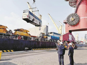
Henan, the heartland of China and a thoroughfare connecting nine regions, serves as a critical integrated transportation hub nationwide. Its expressway network stretches like a powerful circulatory system, underpinning economic circulation and ensuring public mobility. By the end of 2025, the total operating mileage of expressways in the province had reached 10,088 kilometers. As the main force in this increasingly dense modern road network, Henan Transportation Investment Group Co., Ltd. (hereinafter “Henan TransInvest Group”) operates and manages 7,926 kilometers of provincial expressways, accounting for 78.6% of the total, shouldering the heavy responsibility of safeguarding the security and flow of the main transportation arteries.
The expressway network we protect traverses mountains, ridges, hills and plains, with extremely complex geological conditions. Located in a distinct transitional climatic zone where north and south converge, Henan is frequently hit by extreme weather.Summer torrential rains act as an urgent warning drum: they soften the subgrade of silty clay in the eastern Henan plain, erode the support of loess tableland slopes in western Henan, and can easily trigger chain disasters such as landslides and debris flows in the towering mountains of southwestern Henan.Beyond rainstorms, hail, gales, fog patches, ice and snow — frequent visitors to this climatic transition zone — weave an all-pervasive risk web, constantly testing the safety and resilience of the road network.
In the face of such concrete challenges, protection must be comprehensive.The traditional model of “manual defense + physical defense” can no longer cope with all-weather, full-region risks.Only by turning to technology and building an intelligent monitoring and early warning system featuring real-time perception, precise early warning and rapid response can we shift from passive response to active prevention, and truly fortify the lifeline for the safe operation of expressways.
Modern monitoring and early warning starts with comprehensive, accurate and real-time data perception.Henan’s practice is evolving from traditional point-based monitoring to a full-coverage, three-dimensional intelligent perception network, while actively exploring the extension from “passive perception” to “active intervention”.
For high-risk geological disaster areas, long bridges and tunnels — blind spots and difficulties for manual inspection — remote sensing satellites and industrial UAVs act as indispensable “eyes in the sky”.We have completed digital collection and high-precision 3D modeling of trunk highways across the province.Using satellite remote sensing images and intelligent comparison of pre- and post-disaster maps, we can assess the impact scope shortly after a disaster, providing critical decision support for emergency rescue command.In daily management, UAV formations equipped with high-definition photoelectric equipment and LiDAR can rapidly automate inspections of slopes, bridges and pavements, intelligently identifying surface defects with efficiency more than 10 times that of traditional manual inspection.
On the ground, a “digital nerve” network composed of various IoT sensors and AI intelligent cameras has been formed.Across thousands of kilometers of roads, high-definition video surveillance is installed approximately every 2 kilometers, with full coverage on key sections.These cameras are not only “long eyes” for the public to check road conditions, but also a “visual brain” for backstage AI algorithms to analyze traffic flow, incidents and anomalies.
More importantly, for key structures such as high-risk slopes, extra-large bridges and super-long tunnels, we have deployed an array of IoT devices including Beidou high-precision displacement monitoring stations, inclination/acceleration sensors, earth pressure gauges, osmometers and radar surface displacement monitors.These “tech sentinels” capture millimeter-level deformation, internal stress changes, groundwater level and surface displacement data in real time, with second-level transmission via IoT technology.This has completely reversed the passive situation of traditional manual inspection: limited coverage, low precision and delayed response.
While improving the perception network, we are also exploring cutting-edge safety intervention technologies, including the non-contact sonic barrier device.
The system deploys high-gain directional acoustic transmitters in specific road zones (such as early warning risk areas), emitting highly focused special-frequency sound waves that can penetrate vehicle bodies, forming an invisible “sonic wall” in the air ahead.When disasters or unsafe conditions occur, the system can activate the device automatically or remotely upon receiving control instructions and perception data.
Its core advantage is non-contact safety interception, avoiding secondary risks.On high-speed expressways, traditional physical barriers (water barriers, anti-collision buckets) easily shatter upon impact, causing secondary harm to following vehicles, disrupting traffic flow and triggering chain accidents.The sonic barrier achieves “invisible” physical intervention, fundamentally eliminating such secondary hazards.
The device does not alter the original road structure or markings, occupies no driving space, and has no impact on legally passing vehicles under normal conditions.In terms of responsibility definition, it serves purely as an early warning and reminder tool for “warning and persuasion”, not mandatory interception, thus introducing no additional liability risks.
This technological exploration marks a shift in our safety system from “timely detection and alarm after risks occur” to “active and safe intervention and persuasion at critical risk moments”, forming an important part of a complete safety closed loop.
For vast mountainous expressways, deploying high-precision monitoring at every potential risk point entails huge cost pressure.We have therefore introduced and innovatively applied the Disaster Monitoring Sentinel solution.
The system adopts a composite “one line + one network” layout:sensing optical fibers laid on key parts of slopes or bridges (the “line”), integrated with an inclination and low-frequency abnormal vibration sensor network (the “network”).When falling rocks break the fiber or abnormal vibration/overturning is detected, the system triggers an instant alarm.The cost is only 1/10 to 1/3 of traditional schemes, yet it achieves effective disaster qualitative judgment and on-site instant warning, providing a replicable model for large-scale, low-cost improvement of road network safety coverage.
This direction focuses on integrating multi-source data and AI algorithms, realizing early warning from large-scale vague forecasts to precise section-level alerts.
Millimeter-Wave Radar Pavement Icing WarningMillimeter-wave radar monitors pavement icing, combined with visibility, slipperiness and other data from weather stations and pavement sensors.Through cross-validation and AI analysis, the response time for pavement icing warnings is shortened to 5 minutes.Compared with traditional large-scale weather forecasts, it accurately locates high-risk sections such as bridges and tunnel portals, enabling maintenance crews to pre-spread de-icing agents and prevent chain accidents.
Lane-Level Risk Early WarningSupported by “Beidou + 5G” for centimeter-level vehicle positioning, an intelligent early warning system integrating multi-source data is established.It aggregates navigation congestion indexes, pavement monitoring data and meteorological data, predicts section-level traffic risks via AI models, and pushes lane-level warnings to drivers through vehicle-road coordination.This model has reduced expressway accident rates by 45%, overcoming the limited reference value of traditional large-scale warnings.
Refined Night Accident Early WarningA 24-hour dynamic monitoring system is built using “video + infrared” dual-spectrum cameras and AI video analysis.Targeting poor visibility and hard-to-detect accidents at night, the system automatically identifies accidents, spills and other incidents, raising the night accident recognition rate to 92%.By precisely locating the accident section, it provides critical support for rapid rescue positioning and timely traffic diversion.
Structure Monitoring: From “Threshold Overrun” to “Trend Early Warning”Intelligent bridge and tunnel monitoring deploys hundreds of high-precision sensors to capture millimeter-level displacement and stress changes.Moving beyond traditional threshold alarms, the system uses deep learning on historical and real-time data to analyze structural trend changes and provide early warning of initial damage.Since operation, it has successfully detected 15 safety hazards, including abnormal support displacement on Gexi Bridge and sudden cable stress changes on Hongxi Super-large Bridge, enabling management to eliminate risks through preventive maintenance.
Expressway Landslide Trend Early WarningAn intelligent monitoring sentinel system based on YOLOv8 object detection and RNN time-series analysis tracks mountain and pier data changes.It once detected an abnormal cumulative displacement of 5.3 mm on a pier 12 minutes in advance, triggering a Level-3 warning and coordinating traffic police to close the road.Infrared thermal imaging detects abnormal mountain temperatures; combined with time-series analysis, it provides 9-minute advance warning of nighttime debris flows, preventing structural damage and traffic interruption.
Police-Road-Enterprise-Public Security Four-Party Joint ResponseFor illegal activities such as “private cars guiding trucks to bypass checkpoints”, operators, expressway police and local police set up a “data tracing task force”.The multi-source data fusion system provides traffic data and video evidence; expressway police precisely seize vehicles; law enforcement teams identify overloading; public security authorities file criminal cases.A clearly divided closed-loop response chain is formed, cutting off illegal profit chains.
Collaborative O&M of Electromechanical EquipmentAn electromechanical equipment fault early warning system monitors operation data of ETC gantries, tunnel equipment and other key facilities via IoT.After system warnings, a unified platform links O&M departments and operating companies for advanced maintenance.This collaborative model has reduced sudden electromechanical failures by 80%, avoiding congestion and hazards caused by equipment breakdowns and achieving an efficient early-warning-to-response closed loop.
Through years of exploration and practice, we deeply understand that the construction of an expressway monitoring and early warning system is not achieved overnight.It is a systematic project requiring continuous iteration and integrated innovation.
Effective monitoring and early warning is not just equipment installation (“technical defense”), but deep integration of data, algorithms, business processes and personnel experience (“intelligent defense”).For example, the “Pedestrian Prohibition Intelligent Early Warning System” deployed at toll plaza entrances uses video AI to identify intruding pedestrians or non-motor vehicles, automatically triggering sound-light alarms and broadcast reminders.It realizes the shift from passive discovery to active intervention, achieving remarkable safety benefits with low cost.This inspires us that intelligent management often lies in such “micro-innovations” focusing on pain points with small inputs and big effects.
Going forward, Henan TransInvest Group will deepen monitoring and early warning capabilities along two main lines:
From relying solely on “manual defense”, to the combination of “manual + technical defense”, and now to “intelligent defense” as the guide, Henan’s expressways are undergoing a profound safety management revolution.Each precise early warning and each successful risk avoidance witnesses our solid progress from passive response to active protection.
As a pioneer in Henan’s practice of Chinese-style modernization, Henan TransInvest Group will continue to drive safety upgrading through technological innovation.The 10,000-kilometer expressway network covering the central plains will be not only unimpeded economic arteries, but also safe roads ensuring reassuring and comfortable travel for the people.Guarding the ten-thousand-mile thoroughfare, we hold our mission dear and march forward with unremitting efforts.


合作咨询
QQ 5257885在线咨询
合作咨询热线:
13779938068